Updates as of Sept 2017:
Tabur West, East, Far East, Extreme and Extra are closed to public until further notice due to accidents.

SUMMARY
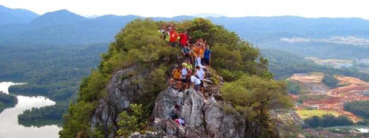
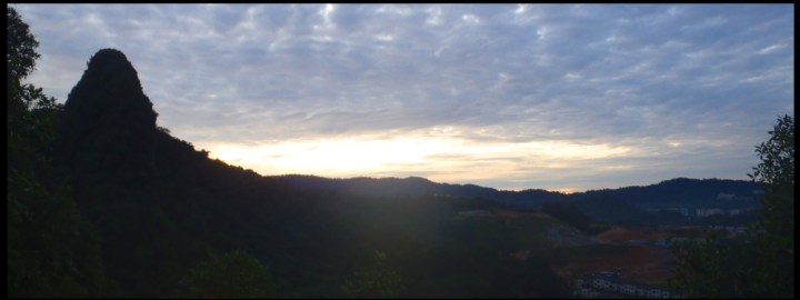
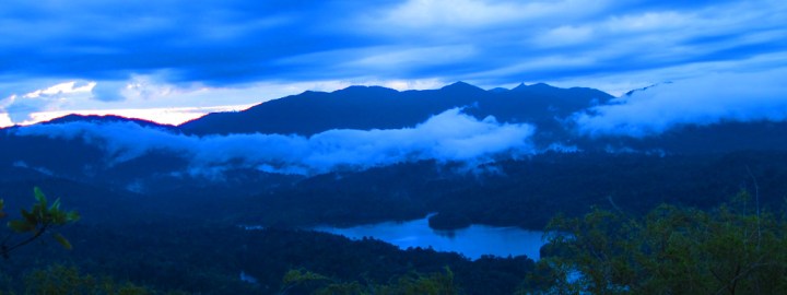
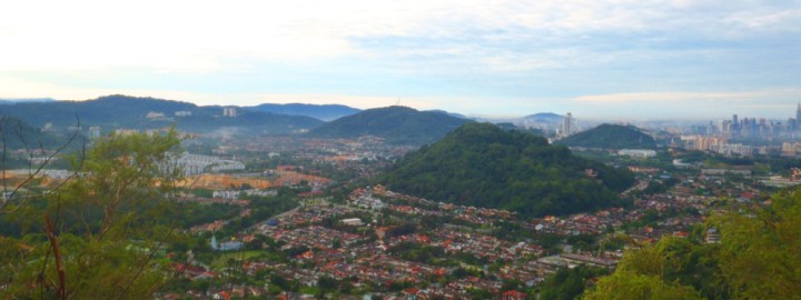
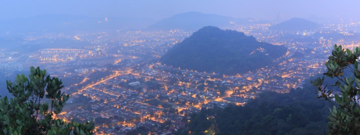
Also known as Bukit Hangus, Bukit Tabur is one of the oldest quartz ridge in the world. Bukit Tabur is located in Selangor at the outer edge of Kluang Valley approximately 20km from Kuala Lumpur. As the trail is a ridge line hike, Bukit Tabur offers a panoramic view of Kuala Lumpur, the Gombak forest reserve and the Klang Gates Dam.
TRANSPORTATION
The start of the west trail is located at approximately GPS coordinates 3.234052, 101.749211 (maps). If you are coming from the south, head towards Kuala Lumpur, which has bus connecting to all major cities.
Driving
It takes approximately 30mins (about 23km) to drive from Kuala Lumpur to the trailhead. Coming from Kuala Lumpur, it is likely that you will be on route 28 heading north. Take the exit and head towards Jalan Taman Melawati. At the roundabout, take the 1st exit to head towards Jalan Melawati 4 and continue straight ahead at the 2nd roundabout. After the 2nd roundabout, turn right at the T junction and right again at the subsequent Y junction. Drive all the way straight till a deadend (gate). The trail is on the left side of the road marked by stairs.
Parking will be an issue as there are no parking lots and the road leading to the trailhead is very narrow. Typically, everyone parks by the roadside which will cause traffic jams.
Public Transport
Coming by coach, head towards Kuala Lumpur – Puduraya Bus Terminal (maps). From the bus terminal, head towards LRT station Plaza Rakyat (ST4) which is located behind the bus terminal. At the LRT station, take one stop (on the Ampang Line (yellow line)) and drop at Masjid Jamek (ST5) to transfer to the Kelana Jaya Line (red line). At the Kelana Jaya Line, head to and alight at station Wangsa Maju (KJ3). From here, you will need to transfer to the town bus T304 at the bus stop below Wangsa Maju station. The bus ride is approximately 15 mins and alight at Taman Melawati GPS 3.228510, 101.748112 (maps). Bukit Tabur is a 10mins walk from the bus stop. From the bus stop, walk on Jalan Melawati and turn left onto a road at GPS 3.230216, 101.749716 to Jalan Kolam Air (unmark road). Cross the bridge, walk under the big pipe and cross the stream, to a grass patch and to a walk up a flight of stairs to trailhead.
KL LRT: http://www.myrapid.com.my/rail/routes
T304 Bus: http://www.myrapid.com.my/journeyplanner/bus/details?code=t304
TRAIL
There are two trailheads for Bukit Tabur, the east and the west trail. The west trail is a more popular route and will be described below. The trail is straight forward but challenging. This is because there are many section on trail where it requires you to use both hands and legs to climb up and down the rock surface. An accidental slip or fall at some of these sections may result in a vertical drop of a few meters. Accidents, deaths and injuries has been reported.
The two more challenging section en route are known at the 1st rope and 2nd rope. The two rope sections consist of a natural rock cliff. To pass the cliff, the hiker need to descent by holding onto a rope while finding his footing. As there are no other support other than the rope to hang on to, a slip or fall may result to severe consequences. Inexperience hikers who are not confident may find the rope section scary and challenging. It is advisable to hike Bukit Tabur with someone more experience and familiar with the terrain.
It is possible to do a traverse for the west trail. Start at the GPS coordinates 3.234052, 101.749211. Depending on how crowded it is and the bottleneck situation, it takes approximately 3 hours to complete the west trail traverse.
| START | Facing the dead end road (a gate), trail on the left. |
| 10 mins | Uneven clearing of about 1 tent area |
| 5 mins | Checkpoint 2 |
| 5 mins | Take right when facing a rockwall |
| 15 mins | Uneven rocky clearing of about 1 tent area |
| 4 mins | Checkpoint 5 – in faint blue. Take left going up |
| 13 mins | Checkpoint 7 |
| 2 mins | Peak 1 |
| 10 mins | Checkpoint 8. Near rope 1 section |
| 25 mins | End of 2nd Ridge |
| 18 mins | End of 3rd Ridge |
| 10 mins | End of 4th Ridge |
| 8 mins | End of 5th Ridge |
| 5 mins | Start Hiking Down (Left trail if i don remember worongly) |
| 30 mins | Hut, Take Right |
| 12 mins |
End Of Hike, in a housing estate. Walk down the road, turn left to go back to starting point. |
COST
Nil
CONTACT
Nil
OTHER
Due to the terrain of the hill, numerous accidents have occurred. Some of the reported accidents are:
Jan 2014: 28 year old female hiker fell 10 meters and suffer injuries on back, hand and face.
Dec 2013: Science teacher in the 30s tumble down a steep slope and died.
Sept 2013: 51 year old man fell 60ms and suffered serious injuries.
Dec 2012: 27 year old engineer fell 100m but survived with minor injuries on his ankle and waist.
Sept 2009: 51 year old man fell, got trap in a tree branch and got stuck for 5 hours before being rescued.
Mar 2009: Two doctors found dead about 500 meters apart after a falling down a cliff.
Oct 2008: A college student fell 100 meters and suffered serious injuries.


Pingback: Bukit Tabur - Hikes For Life Blog